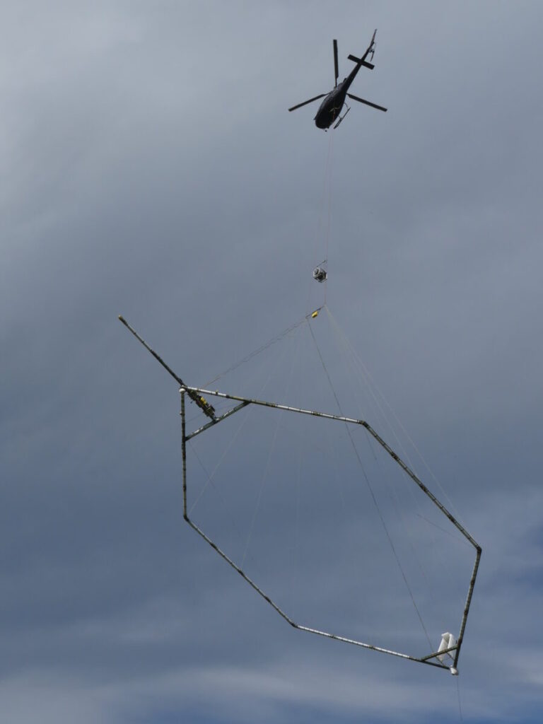
For a few weeks now, a helicopter moving slowly and regularly, carrying a large circular antenna beneath it, has been flying over the Pyrenean reliefs (southwest of France). The operation, which catches the attention of the locals, is not a military exercise, but a long-term scientific mission. Indeed, the Bureau de Recherches Géologiques et Minières (BRGM) is mapping the deep layers of the subsoil in 3D to identify potential freshwater reserves. A first in the mountains, set to expand throughout France and, perhaps tomorrow, around the Mediterranean basin.
AI Index: Mediterranean Knowledge Library
A new technology to detect water buried under the mountains
22-med – October 2025
• In the Pyrenees, the BRGM is mapping the subsoil in 3D to identify potential freshwater reserves.
• An innovative aerial method that could soon extend to the entire Mediterranean basin.
#water #climate #science #mountain #mediterranean
By Olivier Martocq - journalist
“It’s a bit like the valleys are getting an MRI (magnetic resonance imaging - editor's note),” smiles Frédéric Tronel, regional director of BRGM Occitanie, who is overseeing this operation. On board the helicopter, a team of geophysicists measures the electromagnetic signals emitted and returned by the subsoil, with the aim of creating a three-dimensional image up to several hundred meters deep. The goal is to better understand how water flows beneath the mountain ranges. A vital necessity for these mountainous territories where resources are becoming scarce.
“The Pyrenees are no longer the water tower they once were. Climate change is profoundly altering the water cycle, explains the geologist. The snow, which played the role of a natural reservoir and fed rivers in June or July, will be less and less present. Therefore, we will experience very low flows over a longer period, from June to October.” In this context, the BRGM has launched an unprecedented exploration program to identify aquifers buried beneath ancient sediments. Pockets of water that could become strategic reserves in the coming decades.
Below the surface, aquifers buried for millennia
The geological formations targeted by the project were deposited thousands of years ago, during the retreat of the great Pyrenean glaciers. “We know that glacial and morainic sediments can harbor significant volumes of water, sometimes at depths of 300 or 400 meters, details Frédéric Tronel. These potential resources were formed during a different climate, in another time. Our mission is to assess whether they are currently accessible and renewable.”
The mapping obtained from aerial measurements will be complemented by targeted drilling. This combination allows for cross-referencing physical, geological, and hydrogeological data, deducing the exact structure of the aquifers. “We work like a doctor alternating between X-rays, MRIs, and palpation to make a complete diagnosis,” summarizes the researcher. For the Pyrenean valleys, this detailed knowledge of the subsoil could guide decisive choices: the installation of new catchments, adaptation of agricultural practices, or protection of sensitive aquifers.
A new technology
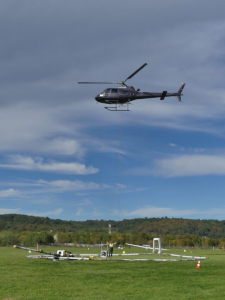
The system implemented by the BRGM relies on airborne electromagnetic geophysics. Suspended beneath a helicopter, an antenna emits an electromagnetic field that penetrates the subsoil. Depending on the nature of the rocks — their conductivity, water, or clay content — the signal is reflected differently. These variations are recorded and then modeled by computer, producing a continuous 3D image up to 300 m deep.
This method, already used in plains, is being deployed here for the first time on a large scale in a mountainous region. It allows for coverage of entire areas, often inaccessible on foot. “In just a few days of flying, we obtain information that would take months to acquire from the ground, emphasizes Frédéric Tronel. It’s cutting-edge technology, but also a fantastic tool for public knowledge: the data is fed into the Geological Reference of France.”
The BRGM has been developing this expertise for over ten years, combining electromagnetism, magnetism, and gamma radiometry. This data is added to that from drilling and field surveys to create a true three-dimensional map of the French subsoil. Beyond research, the stakes are political and environmental: “Improving knowledge of the subsoil also helps territories better manage their water resources, plan uses, and anticipate future tensions.”
From the Pyrenees to the Mediterranean: a replicable method
The Pyrenean experiment, funded by the state and local authorities, will last four years. But already, the BRGM envisions its extension to other regions. “What we are doing here could be replicated in the Alps, the Massif Central, Corsica,” suggests Frédéric Tronel. The applications are numerous. In coastal areas, the technique could be used to monitor the salinization of aquifers or to identify vulnerable freshwater layers. In inland basins, it would help predict the effects of climate change on aquifer recharge. “Each territory has its geological signature, but the method remains the same: observe, understand, anticipate,” insists the regional director. The BRGM thus positions its action within a long-term vision: a water transition that combines scientific innovation and territorial governance. “We often speak of climate adaptation as an abstract concept. Here, it plays out in the rock, in the knowledge of the subsoil.”
Ultimately, the 3D mapping resulting from the aerial campaigns will be made available to local authorities and water managers. It will also serve to enrich the Geological Reference of France, the large national database on the structure of the subsoil. The BRGM could thus build, region by region, a complete vision of the country’s underground water reserves. An approach that could inspire other Mediterranean territories facing the same challenges. “We must think deeply,” concludes Frédéric Tronel. Water is no longer managed only on the surface, with rivers and dams. It is managed in the subsoil, where it flows, accumulates, or disappears. Understanding this is learning to manage a living resource.”
Frédéric Tronel is a trained geologist, engaged in engineering and environmental expertise. He currently serves as the Deputy Regional Director of BRGM Occitanie – Toulouse Delegation - where he coordinates the scientific and technical activities of the Occitanie agency in Toulouse. Before joining the BRGM, he worked for nearly 30 years in a consulting firm (notably at Burgeap Sud-Ouest) where he led multidisciplinary teams on topics such as contaminated sites and soils, water resources, and energy.
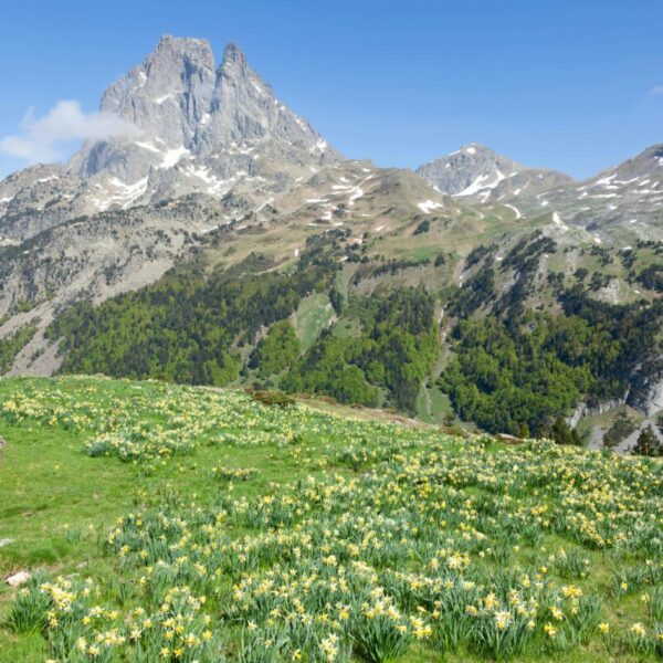
Cover photo: Laruns - Pyrenees ©Philippe-Serrand-Pexels